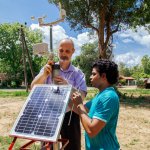
Wifi planned for installation in a volcano in Nicaragua to collect data
September 7, 2016 3:10 pm Published by Simone Balog Leave a commentRMS releases suite of Europe inland flood risk data
September 7, 2016 3:04 pm Published by Simone Balog Leave a commentScience can map a solution to a fast-burning problem
August 23, 2016 10:59 pm Published by Simone Balog Leave a comment‘DataSculpture’ on flood risks
August 15, 2016 8:05 pm Published by Simone Balog Leave a commentPreparation and innovation key to reducing risk, and ‘a few days’ can decide life or death, 2016 Understanding Risk Forum hears
August 15, 2016 8:02 pm Published by Simone Balog Leave a commentMaking Disaster Relief More Like Funeral Societies: A Review of Dercon and Clarke’s Dull Disasters
August 7, 2016 9:26 pm Published by Simone Balog Leave a commentThe First Integrated Methodology for Development of Flood Hazard Maps and Risk Maps in BiH
August 7, 2016 9:25 pm Published by Simone Balog Leave a commentA new method for assessing flood risk
August 7, 2016 9:23 pm Published by Simone Balog Leave a comment
Management requires measurement: Reducing flood damage by improving response time
May 23, 2016 6:55 pm Published by Simone Balog Leave a commentby Soumya Balasubramanya and Yann Chemin
The International Water Management Institute (IWMI) is piloting open-source mobile weather stations with the Irrigation Department in the Nachchaduwa catchment, in Sri Lanka. Funding comes from the Global Facility for Disaster Reduction and Recovery (GFDRR) through the Challenge Fund.
The Nachchaduwa reservoir is an important source of water for irrigation in the district of Anuradhapura. Reservoir managers try to maintain full supply level, to accommodate demands for irrigation water. In the monsoon season, the managers try to balance maintaining full supply level with creating enough storage volume to accommodate runoff from the upper catchment. This decision-making is complicated by the paucity of rainfall data, which is reported by the meteorological department once a day, as a daily average. During the monsoon, this sparse reporting is not sufficient to make timely decisions regarding what volume of water should be released prior to the runoff entering the reservoir. Consequently, the reservoir spills, and floods the agricultural and residential land in the lower catchment.
With access to timely data on rainfall intensity, reservoir managers state that they would have more time to prepare the reservoir to accommodate runoff from the upstream catchment during the northeast monsoon. “Flashfloods are becoming more common in the catchment during the monsoon, and having access to data on hourly rainfall intensity in this season is required for managing the reservoir and reducing damages from flooding”, said Mr. Lasindu Kovilaarachchi, Divisional Irrigation Engineer, Nachchaduwa, in a meeting with the project team on April 20, 2016.
Responding to a request from the Irrigation Department, five open-source mobile weather stations have been installed in the upper catchment of the Nachchaduwa reservoir, and have been programmed to send SMS text alerts when rainfall intensity exceeds 10mm/hr. Reservoir managers estimate that it takes around 8 hours for rainfall in the upper catchment to enter the reservoir; with hourly data, response time for managing the reservoir is improved, helping to reduce damages from flooding.
These weather stations were created by Yann Chemin (IWMI), using open source hardware and software. Each station consists of an Arduino microcontroller, a weather shield, a GSM board, weather sensors, and a micro-SD card. Access to the manuals for assembling, maintaining and programming the stations can be found at: http://www.iwmi.cgiar.org/resources/mobile-weather-stations/.
Using local parts and labor, the stations cost less than USD 500 per installed unit. A cost-effectiveness study conducted by Soumya Balasubramanya and Richard Hardy (IWMI) demonstrates that even if extreme rainfall occurred once every five years, and even if small reductions in area and duration of inundation are achieved through better reservoir management, the post-disaster rehabilitation expenditures of the government would be substantially reduced. The cost of installing these five units would be recovered in 2.5 years.
Mobile weather stations are being used in Sri Lanka by a number of government departments, universities, and non-governmental organizations. To connect a community of professionals, Farah Ahmed and Mohamed Aheeyar of IWMI is organizing a workshop on the 3rd of May in Colombo to discuss the experiences of using open source weather stations, and to understand the opportunities for and constraints in the use of such technology in Sri Lanka.
In addition, IWMI and the GFDRR are organizing a side event at the ‘Understanding Risk 2016’ conference on May 16, from 0900 to 1700, titled ‘Build a mobile weather station in one day with open source hardware and software’. This session will consist of a demonstration for assembling and activating weather stations. Speakers from Asia, Africa and the Caribbean will follow the demonstration, to discuss the experiences, opportunities and challenges of using these devices in various applications. For details see: https://understandrisk.org/event-session/open-source-hardware-software/
—
To contact the authors:
Soumya Balasubramanya (s.balasubramanya@cgiar.org)
Yann Chemin (ychemin@gmail.com)
