Risk information from the decision maker’s perspective: What they wish you knew and what they need you to tell them

October 28, 2020 3:47 pm Published by Leave a comment


Risk information from the decision maker’s perspective: What they wish you knew and what they need you to tell them

Organizer: REAP

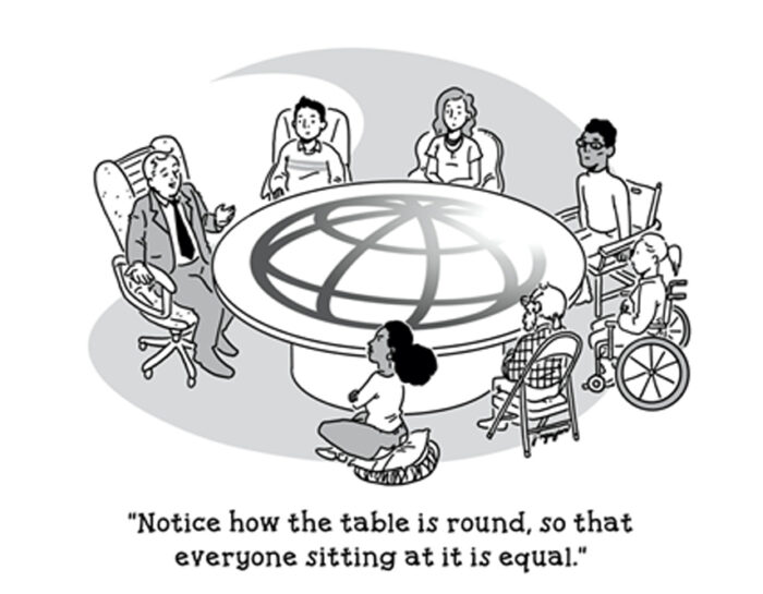
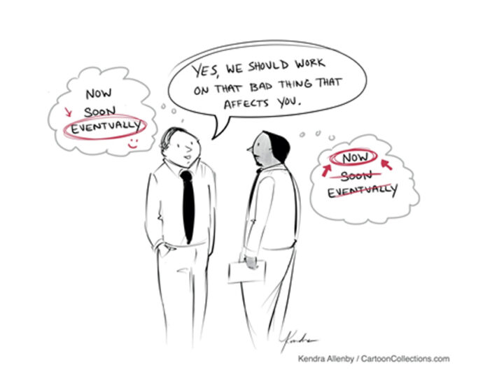
Globally, regionally, and in many contexts, nationally we have unprecedented access to early warning information and risk analysis. At the same time, many organizations, governments and communities are gradually moving from a reactive to proactive approach to crisis and disaster risk management. The need for this switch in approach is underlined and highlighted by the realities of the global climate crisis. Crises are increasingly predictable, but they are also increasingly frequent and severe. We know so much more about the nature, impact and likelihood of crises and yet actions are still often in response rather than in advance of them. In recent years, there has been a substantial increase in governments, organizations and communities attempting to shift from response to anticipation. Actors such as the RCRC movement, the UN, CSO networks such as Start Network and NEAR Network and sector leading governments such as Bangladesh have pushed the early action agenda. But there is still quite some way to go in making early action a norm. So, we know that it is unacceptable that, given the wealth of EW and risk analysis information that we have at our fingertips, our defacto mode of operation is to wait for communities to slide in to crisis before we take action. What is stopping us making early warning informed early action the rule rather than the exception? A significant barrier to scaling, systemizing and consolidating EWEA approaches in crisis and climate vulnerable countries can be found at the very first step – the collection and communication of risk and early warning information for those who have the capacity and duty to act upon it. Early Warning systems are only as good as the Early Action they result in. While there are very rich discussions at global and regional policy level, it is fair to say that this is not consistently translating and transmitting to the level at which critical decisions to act or, preferably, act early, are made. It is crucial that we shift the narrative and consultation to those who make decisions about impending crises, whether they are short, medium or long term. The confidence and willingness to act under certainty is a cornerstone of Early Action and it is essential at this juncture that we look to decision makers, be they at a community or government level, and ask them “what is that you need from us to act early? Are the steps and processes we are undertaking now useful to you when it comes time to make difficult decisions? And if not, how can we better serve and support? What do we need to do together to make early action business as usual?” In this session, we will listen to very frank and open inputs from critical decision makers on what we’ve gotten right on communicating risk information for early action and, more importantly, where we have gotten it wrong and urgently need to rectify/address. In section 1 (first 55 minutes session) we will hear from decision makers at every level. They will tell us what it is they need, when and how in order to make decisions to act early. After initial presentations by speakers, a short Q+A session will be moderated by REAP Head of Secretariat using questions from the audience. Speaker panel will be made up of a rep from each of the following categories: – Crisis/Climate Vulnerable Government – Institutional Donor Government/Body • Crisis/Climate Vulnerable Community Rep – National/Local CSO Rep – International CSO Rep Each speaker will conclude with 1 to 3 asks/demands of REAP/the broader EWEA community In section 2 (second 55m minutes session) participants will be divided in to breakout rooms categorized by the sector/area of EWEA their organization works in. They will be asked to consider the following questions: – How does your organization/sector’s current way of working enable the asks/demands expressed in section 1 of the session? – Based on what you’ve heard from panel members, how could you change your way of working to better suit those who need it? – What is the role of REAP in facilitating these asks/demands and what is the role of you as REAP partners/potential partners/EWEA actors to drive this agenda forward? What are the tangible action points that we will take from this session to COP26 and beyond?

Speakers:
Lisa Robinson, Head of Advisory
Jahin Shams, Programme Development Specialist
Lawrence Dimailig, Deputy Director
Outi Myatt Hirvonen, Senior Advisor, Environment and Climate
Maurine Ambani, Regional FbF Coordinator
Aderito Aramuge, Meteorologist
Gavin Ileys , Crisis Management and DRR Expert
Steven Ramage, Head of External Affairs


Precipitation in Africa: the future of observation, nowcasting and forecasting

October 28, 2020 3:45 pm Published by Leave a comment


Precipitation in Africa: the future of observation, nowcasting and forecasting

On the world’s fastest urbanizing continent, Africa, urban floods are a big and growing problem. Early warning is the first important step in flood risk management. This requires continuous and reliable precipitation measurements and forecasts, which are not always available in African cities. Four experts form a panel for this session. All of them have their own innovative way to overcome the precipitation information challenge in Africa. Their solutions include the use of machine learning combined with earth observation data, the design of low-cost sensors, and the application of commercial microwave links from cellular telecommunication networks for precipitation observations. Frank Annor will share how the Trans-African Hydro-Meteorological Observatory (TAHMO) pursues its aim to build a station every 30km in sub-Saharan Africa, requiring 20,000 stations to be placed. They developed a rain gauge that can be produced for 100 euros, about 10% of the costs of other rain gauges. Aart Overeem, researcher at the Royal Netherlands Meteorological Institute (KNMI), derives precipitation amounts using commercial microwave links from cellular telecommunication networks. He works on upscaling this rainfall measurement technique in low- and middle-income countries. He conducted pilot studies in Nigeria and Sri Lanka. Bashiru Yahaya, from Ghana Meteorological Agency (GMet) knows from first-hand experience the importance of rainfall information in Ghana. He will elaborate on their efforts to improve precipitation observations and forecasts for Ghana. He is working on nowcasting models for early warning systems. Dorien Lugt will present how she applies machine learning to generate nowcasts from satellite observations. HKV discloses precipitation observations derived from the geostationary satellite MSG in a web- and mobile phone application. These are available every 15 minutes for the entire African continent, with smaller latency and higher spatial resolution than other free available products. She uses machine learning models to forecast precipitation 3 hours ahead. The panel members will share their stories and ideas in a short pitch. Afterwards, they will discuss with the audience the future of precipitation monitoring, nowcasting and forecasting in Africa. The session will be facilitated by Carolien Wegman from HKV.

Organizer: HKV, GMet, KNMI, NADMO, TAHMO


Nature-based solutions: Balancing risk and societal benefits

October 28, 2020 3:44 pm Published by Leave a comment


Nature-based solutions: Balancing risk and societal benefits

Organizer: Norwegian Geotechnical Institute, University of Bologna, IHE Delft, ICATALIST

The increasing frequency and severity of hydro-meteorological events on land and sea have a high impact globally. The science behind these phenomena is complex and multi-disciplinary as the international scientific community explores solutions that not only mitigate the impact of hydro-meteorological events but also can contribute to disaster risk reduction and achieve the broader goals of the Sendai Framework, as well as the Sustainable Development Goals of the United Nations. The implementation of nature-based solutions (NBS), solutions that are inspired and supported by nature, have the potential to reduce the risk of extreme hydro-meteorological events and simultaneously provide environmental, social and economic benefits and help build resilience. This Focus Day event therefore aims to i) explore how balancing perspectives can improve the implementation of nature-based solutions (NBS) to reduce hydro-meteorological risks; and ii) promote and share experience currently being developed in Europe and Asia with the best available science and knowledge to establish a coherent approach towards risk management. Examples will be presented from NBS Hydro-Met Task Force supported by the flagship European Union’s Horizon 2020 Work Programme, which comprises four research and innovation action projects (NAIAD, OPERANDUM, PHUSICOS and RECONECT, with a total funding amounting to some 40 million euros) that design, implement and evaluate innovative and locally-attuned NBSs for hydro-meteorological risk reduction at the watershed and landscape scale.

Speakers:
Ken Ho, Deputy Head of the Geotechnical Engineering Office of the Hong Kong
Anna Scolobig, Risk researcher, University of Geneva and IIASA
Dayan Munasinghe, Senior Scientist at the National Building Research Organisation
Henglin Xiao, Professor, School of Civil Architecture and Environment, Hubei University of Technology
Zoran Vojinovic, Associate Professor of Urban Water Systems at IHE Delft


Building Climate Resilience together: Race for Resilience along shared Marrakech Partnership pathways.

October 28, 2020 3:42 pm Published by Leave a comment


Building Climate Resilience together: Race for Resilience along shared Marrakech Partnership pathways.

Organizer: GRP / CRN + FAO/A2R *this session is part of the Development & Climate Days

This event will focus on the need for ambitious actions to build resilience, identify what can be done in the run-up to COP26, and how to set up a decade of action. Nigel Topping, the UK High Level Climate Champion, will share plans on the Race for Resilience, a complementary campaign to Race to Zero. This session is held with the aim to further support the planned campaign and to collect further reflections from the broader audience in line with the recently updated MPGCA Adaptation and Resilience pathway which supports the collective vision: By 2050 we all live in a 1.5 degree warmer world where all regions, countries, cities, businesses communities and individuals THRIVE in the face of multiple risks, uncertainty and threats posed by climate change. 

Speakers:
Nigel Topping, UK High Level Champion, COP26
Sheela Patel, Founder and director of the Society for the Promotion of Area Resource Centres (SPARC) and GCA Commissioner
Hindou Oumarou Ibrahim, Community leader, AFPAT, and Senior Indigenous Fellow for Conservation International
Sylvie Wabbes Candotti, Agronomist, Emergency, and Resilience Officer at Food and Agriculture Organization of the United Nations (FAO)


Racism, Exclusion & Risk: Harnessing Humor for Hard Conversations

October 28, 2020 3:40 pm Published by Leave a comment


Racism, Exclusion & Risk: Harnessing Humor for Hard Conversations

Organizer: Global Facility for Disaster Reduction and Recovery and the World Bank’s Social Sustainability and Inclusion Global Practice.
It builds off a World Bank Anti-Racism workshop developed by World Bank’s Social Sustainability and Inclusion Global Practice.

The widespread prevalence of racism in our society and institutions shapes disaster risks. Mechanisms of differentiation based on race are determinants in the social construction of vulnerability and exposure, perpetuating systemic patterns of exclusion and privilege. By overlooking reality, people and organizations often fail to notice racism, or anticipate the risks this can engender and entrench. We can do something about it… But how to initiate constructive conversations on the difficult intersection of race and risk? Humor can help. Join this interactive “cartoonathon” session to confront what’s unacceptable yet accepted. We will have and co-create serious fun with cartoon artists Emily Flake, Feggo and Yasin Osman, guided by risk-taker Pablo Suarez. The cartoons emerging from your input during this session will feed into UR2020’s concluding plenary on anti-racism, inclusion and resilience.

Speakers:
Regie Gibson
Janot Mendler de Suarez
Pablo Suarez, Associate Director for Research and Innovation, Red Cross Red Crescent Climate Centre
Emily Flake, Artist
Yasin Osman, Artist
Felipe Galindo, Artist


The Risk Data Library Project: Developing an open standard for risk data

October 28, 2020 3:38 pm Published by Leave a comment


The Risk Data Library Project: Developing an open standard for risk data

Organizer: Global Facility for Disaster Reduction and Recovery GFDRR

Disaster risk assessments are more important than ever, but common issues with risk data interoperability mean we are not maximizing their value for reducing risk to the most vulnerable populations and countries. The Risk Data Library was launched to address those issues. The project led by the GFDRR aims to provide an open data standard and tools designed specifically for the needs of disaster risk practitioners. By combining hazard, exposure, vulnerability and loss data together through a consistent schema the Risk Data Library makes it easier to work with various sources of disaster risk information and build more efficient data workflows, catalogs and tools. Ultimately, the goal of the Risk Data Library is to build and support a community of risk data librarians, generating, curating and sharing risk data collectively on the web. This session will bring together producers and users of risk data to discuss the value of the open data standard and to consider how to make this a sustainable tool for all. Panelists will include representatives from Global Earthquake Model Foundation, University College London Institute for Disaster and Risk Reduction, The Earth Institute Columbia University, OASIS Loss Modeling Framework, Red Cross Climate Centre and the City Resilience Program of GFDRR and the World Bank.

Speakers:
Pierre Chrzanowski, Disaster Risk Management Specialist, GFDRR
Jamal Dabbeek, Junior Researcher, EUCENTRE
Ross Eisenberg, Urban Planning and Disaster Risk Management Consultant, World Bank
Carmine Galasso, Associate Professor of Catastrophe Risk Engineering, UCL
Adam Sobel, Professor at Columbia University Earth Observatory
Irene Amuron, Techincal Advisor, The Climate Centre
Dickie Whitaker, Chief executive, Oasis Loss Modelling Framework Ltd
Stuart Fraser, Disaster Risk Management Specialist, GFDRR


Harnessing the evolution of earth observations and risk

October 28, 2020 3:37 pm Published by Leave a comment


Harnessing the evolution of earth observations and risk

Organizer: Earth Observations (GEO)

Group on Earth Observations (GEO) is an international partnership of governments and organizations working towards a future where decisions and actions for the benefit of humankind are informed by coordinated, comprehensive and sustained Earth observations (EO). As a Participating Organization of GEO, the Committee on Earth Observation Satellites (CEOS) ensures international coordination of civil space-based EO programs and promotes exchange of data towards similar goals. Our complex planet is made up of numerous processes in the atmosphere, ocean and on land, but to fully understand and navigate new normals that introduce increasing systemic risk, we must not only understand individual processes, but the connections between these processes as well as their baselines. Earth system science, informed by EO, provide this critical systems perspective. This Virtual Community Session will highlight a number of efforts from the GEO and CEOS communities, providing an opportunity for the Understanding Risk community to gain insights about latest Earth observation applications addressing risk reduction in tangible ways around the world.

Speakers:
David Borges, Physical Scientist
Janet Edwards, Sweden National Focal Point, Sendai Framework for Disaster Risk Reduction, Swedish Civil Contingencies Agency (MSB)
Ricardo Quiroga, Coordinator of the NASA Disasters Program for the Americas
Fabian Löw, Research Officer, National Focal Point Copernicus EMS
Laila Kühle, Research Officer, National Focal Point Copernicus EMS
Sang-Ho Yun, Geophysicist / Radar Scientist
Helene de Boissezon, Manager, Space Applications for DRM, DRR and Insurance, CNES, French Space Agency
Dalia Kirschbaum, Hydrological Sciences Lab Chief


Fire resilience at the urbanising margins

October 28, 2020 3:35 pm Published by Leave a comment


Fire resilience at the urbanising margins

Fire kills an estimated 150,000-180,000 people per year, 95% of whom live in LMICs 1. In addition to the lives lost, 10 million disability adjusted life years (DALYs) are lost each year, and each year fire costs between 1-2% of global GDP 2. All other natural hazards combined kill an estimated average over 10 years of 70,000 deaths per year and a cost of 0.2% of global GDP 3. Global fire death rates 4 and distribution of informal settlements 5 are well correlated. Given the rapid urbanization that is occurring in Africa and South East Asia, where there are already large numbers of informal settlements, it is only intuitive that the fire deaths will increase. Therefore, there is a pressing need to understand the risks within these settlements. In this event, you will learn the current state-of-the-art knowledge and techniques to understand and map fire spread risks in informal settlements. Using examples from the IRIS-Fire research project in Cape Town, South Africa we will discuss the different social, spatial, and physical fire risks and how this can inform participatory dialogues between communities and municipalities to Improve the Resilience of Informal Settlements to Fire. The session will be interactive looking at spatial arrangements of informal settlements, followed by a panel discussion on the linkages between social, spatial, and physical fire risks. This session will also provide time and space for Q&A discussions with the audience. 1. Rush, D. et al. Fire risk reduction on the margins of an urbanizing world. Glob. Assess. Rep. 2019 1–25 (2019). 2. The Geneva Assocation. Fire and Climate Risk. World Fire Stat. Bull. 1–18 (2014). 3. IFRC. World Disasters Report 2016. Resilience : saving lives today, investing for tomorrow. Disasters (2016). doi:10.1037/e569662006-003 4. UN-Habitat. Our World in data – Cause of death. (2020). Available at: https://ourworldindata.org/causes-of-death. (Accessed: 21st February 2020) 5. UN-Habitat. Our World in Data – Urbanization. (2020). Available at: https://ourworldindata.org/urbanization. (Accessed: 21st February 2020)

Organizer: School of Engineering, University of Edinburgh

Speakers:
David Rush, Senior Lecturer in Structural Engineering
Dr Lesley Gibson, Geospatial Scientist, University of Edinburgh


Geohazard risk monitoring and mitigation approaches for increasing the Himalayan road network resiliency against climate change

October 28, 2020 3:33 pm Published by Leave a comment

Geohazard risk monitoring and mitigation approaches for increasing the Himalayan road network resiliency against climate change

In order to achieve a resilient management of transportation networks, the impacts related to the occurrence of natural hazards as well as those derived from climate change have to be taken into consideration. For doing so, vulnerable elements of the infrastructure must be identified, and based on their risk of failure, maintenance interventions can be prioritized, and adaptation/mitigation measures can be designed and implemented. This session presents, on one hand, two case studies where a risk-based road asset management methodology has been designed and turned into management tools for Road Administrations in the Himalayan region (Bhutan and Nepal). On the other hand, two additional case studies are presented where new technologies such as remote sensing or PSIn-SAR have been used for the monitoring of geohazards and high-risk assets in this region. The combined implementation of these technologies and tools thrive for the increase of infrastructure resilience and the improvement of resilient transportation asset management, while building capacity in the region for fighting against the increase in number and magnitude of landslides due to climate change impact.

Organizer: Michigan Technological University; KOKUSAI KOGYO CO; icem – International Centre for Environmental Management, INES Ingenieros, World Bank, JICA, BHUTAN DOR

Speakers:
Masatsugu Takamatsu, Disaster Risk Management Specialist
Marta Pertierra Rodríguez, Consultant for Disaster Risk Management
Thomas Oommen, Professor, Director, Computational Science & Engineering
Ryota Hasegawa, Consultant for Disaster Risk Reduction
Miguel Coulier, Technical Program Director


Disruptive Tech for Africa: tracking the latest urbanization trends with local validation

October 28, 2020 3:31 pm Published by Leave a comment


Disruptive Tech for Africa: tracking the latest urbanization trends with local validation

Organizer: University of Twente, DLR, MindEarth, Ardhi University / Resilience Academy

African cities are challenged by rapid uncontrolled urbanization. Sub-Saharan Africa is one of the world’s fastest urbanizing regions. Urban areas were home 472 million people in 2017, and are expected to double over the next 25 years. Previously, drought and food security have been the main challenges facing a predominantly rural population in Africa. Rapid urbanisation and climate change is shifting the risk profile and towards urban challenges including flooding, landslides, and earthquakes. We can reduce risk to people in cities through the timely collection of actionable risk data including: how fast, where, and how cities are growing. The German Aerospace Center (DLR), funded by the World Bank, is launching a new suite of datasets in the World Settlement Footprint (WSF) suite which use Earth Observation satellites to track urbanization patterns up to 2019, types of urban expansion, impervious surfaces, and population growth. The heightened impact of global public health emergencies such as the COVID-19 pandemic underscore the need to build local skills to create the required digital information while providing learning and livelihood opportunities.At the same time, the production of these global WSF layers requires extensive validation. Successful pilots are showing how digital microtasking can engage African youth to validate global urbanization datasets – thus simultaneously ensuring the quality of the global urbanization datasets, creating employment opportunities for African youth, and providing learning opportunities on valuable digital skills. This session will give a sneak-peak of new, free datasets from the World Settlement Footprint suite, which track urbanization patterns with unprecedented detail and timeliness. We will challenge you with questions on the current state of the world, and show datasets which can help answer these questions. We will also show how you can benefit from street-view imagery and the synergies of digital microtasking – collecting local, high-quality validation data while creating employment opportunities and supporting digital skill development.

Speakers:
Dr. Caroline Gevaert, Assistant Professor
Dr. Thomas Esch, Head of the Smart Cities and Spatial Development Team
Dr. Mattia Marconcini, Engineer and Project Manager in the Smart Cities and Spatial Development team
Dr. Davide Cucci, Researcher
Dr. Zakaria Ngereja, University Lecturer